

The rock carvings were discovered by an international team of archaeologists, led by the Heritage Commission of the Saudi Ministry of Culture, and including scholars from the Max Planck Institute of Geoanthropology, King Abdullah University of Science and Technology (KAUST), University College London, Griffith University’s Australian Research Centre for Human Evolution (ARCHE), and others. Their findings were published open access in Nature Communications a few days ago.
At the time, the region that is now arid desert was made habitable by a humid period following the Last Glacial Maximum (LGM), when surface water was abundant. Stone tool manufacture from the site shows clear cultural links with Neolithic societies in the Levant—ironically, the very region where the authors of Genesis set most of their imaginative origin myths, apparently oblivious to the deeper history of the area or the existence of earlier human populations beyond their narrow horizons.
The research and its significance are the subject of an article in The Conversation by four of the study’s authors. Their article is reproduced here under a Creative Commons licence and reformatted for stylistic consistency.
12,000-year-old rock art marked ancient water sources in Arabia’s desert
Sahout Rock Art and Archaeology Project
Maria Guagnin, University of Sydney; Max Planck Institute of Geoanthropology; Ceri Shipton, UCL; Frans van Buchem, and Michael Petraglia, Griffith University
About 12,000 years ago, high up on a cliff in the desert of northern Arabia, an artist – or perhaps artists – was hard at work. Standing on a narrow ledge and with primitive tools, they engraved into the rock an image of a life-sized camel. This wasn’t the first artwork of its kind: in fact, there was already an entire row of fresh camel engravings on the 39-metre-high cliff face, below which a shallow lake sparkled in the sunshine.
Over thousands of years, these engravings weathered the elements. They gradually eroded until they were almost invisible and had been forgotten.
That is, until our international team discovered them and more than 170 others while on a field trip to the region, which sits near the southern edge of the Nefud Desert in Saudi Arabia, roughly two years ago.
As we explain in a new study, published today in Nature Communications, the engravings would have marked important desert water sources – and demonstrate the resilience and innovation of people who lived in such a harsh, arid environment.
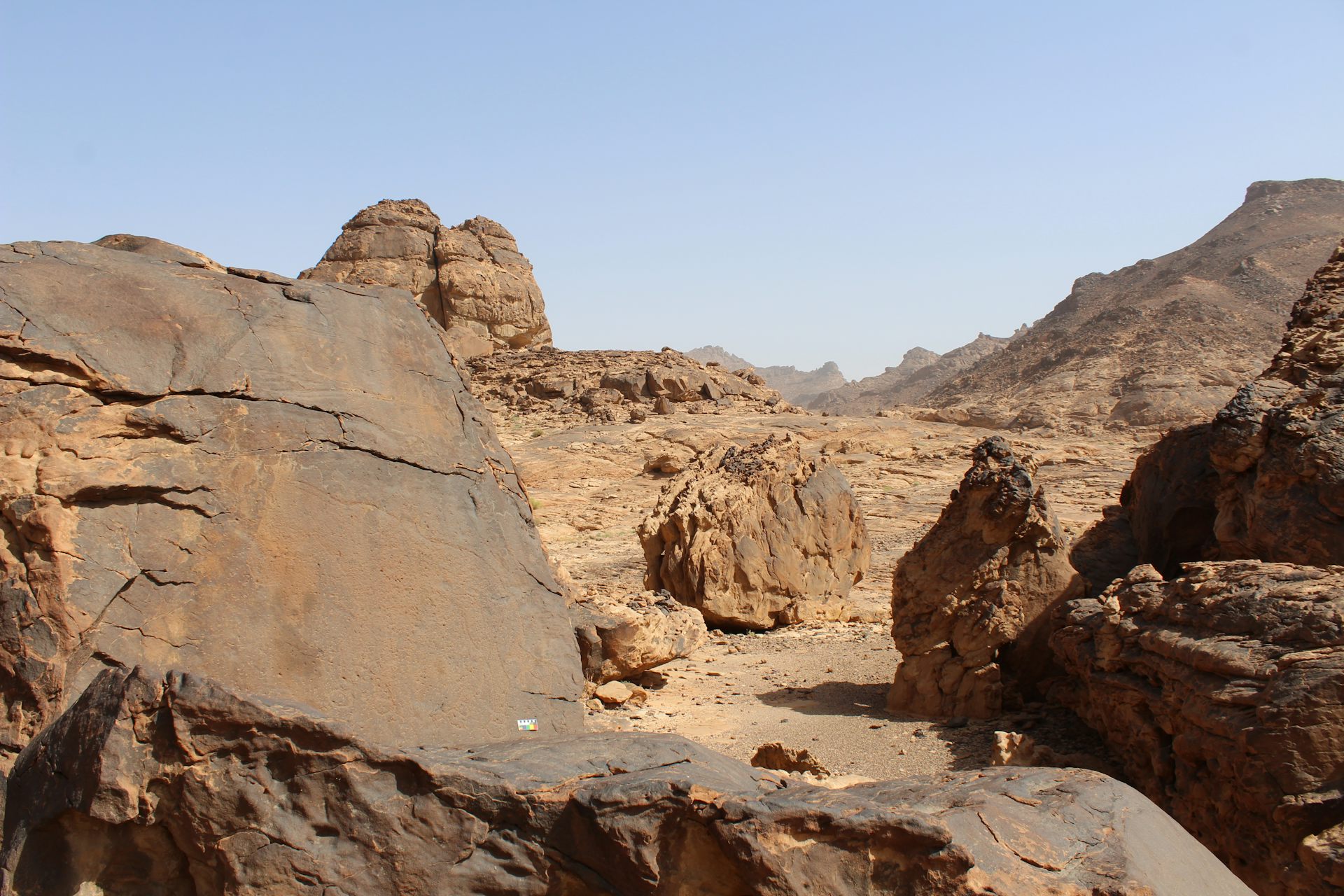
The engravings are near the southern edge of the Nefud Desert in Saudi Arabia.
Sahout Rock Art and Archaeology Project
Searching for clues
Our earlier research had shown that between 10,000 and 6,000 years ago Arabia was much wetter than it is today.
Grasslands had spread into areas that are now desert, and cattle herders used these pastures for their herds.
The rock art they left behind is well known from two UNESCO World Heritage sites.
We could see there was also older rock art at these UNESCO sites. It was much larger and more detailed, showing life-sized and naturalistic camels and wild donkeys. But it was not clear how old it was. So in May 2023 we set out to find more of this ancient rock art in the hope of finding clues about its age.

The newly discovered engravings include 130 images of large, life-sized animals – camels, ibex, wild donkeys, gazelles and aurochs.
Sahout Rock Art and Archaeology Project
In total, we identified more than 60 rock art panels containing 176 engravings in three previously unexplored areas – Jebel Arnaan, Jebel Mleiha and Jebel Misma. The engravings include 130 images of large, life-sized animals – camels, ibex, wild donkeys, gazelles and aurochs. Some are almost three metres long and more than two metres high.
We reached the first panel via a long off-road track which cut through a beautiful mountain landscape. A cool breeze made the heat of the emerging Saudi summer bearable.
The rock art panel showed two large camels, one on top of the other. The older camel looked as though it was in motion and about to stand up, the other like it was striding across the rock surface.
We were excited to find undisturbed archaeological layers directly beneath the engraved camels. In one sealed layer we even found an engraving tool that was once used to make rock art.
Luminescence dating – a dating method that measures when sediment was last exposed to sunlight – revealed the layer in which the tool was found is about 12,000 years old.
The same layer also contained artefacts that are typical for this time, including small arrowheads, stone beads and even a bead made from a seashell.

An arrowhead uncovered during excavations.
Michael Petraglia
These artefacts tell us the people who made the rock art were part of a far-reaching network. They used the same stone tools and jewellery as communities in the Levant, 400 kilometres further north.
Significantly, our team also discovered the rock art was placed near ancient seasonal lakes.
At the end of the last ice age, during the Last Glacial Maximum, the climate was extremely dry.
These lakes, dated at roughly 15,000 years, are the first evidence of surface water returning to Arabia following the extremely arid period. And they move the timeline of the returning humid conditions back thousands of years, enlarging the opportunity window for humans to settle in these dry inland conditions.
Our results show 12,000 years ago, humans were able to use these seasonal lakes to survive in the desert. They marked these water sources, and the paths leading to them, with monumental rock art.
We don’t know why they did this. But even for us today, the camel is a striking symbol for survival in the desert.
Maria Guagnin, Director, Ha’il Archaeology Identification Project, University of Sydney; Max Planck Institute of Geoanthropology; Ceri Shipton, Lecturer in Palaeolithic Archaeology, UCL; Frans van Buchem, Professor, Earth Systems Science and Engineering, and Michael Petraglia, Director, Australian Research Centre for Human Evolution, Griffith University
This article is republished from The Conversation under a Creative Commons license. Read the original article.
Monumental rock art illustrates that humans thrived in the Arabian Desert during the Pleistocene-Holocene transitionWhat makes discoveries like this so significant is not just what they reveal about our shared human past, but also what they quietly but powerfully undermine. If the biblical flood had truly occurred as described in Genesis—a global, all-destroying deluge mere thousands of years ago—then these carvings, along with countless other archaeological sites around the world, simply could not exist. Rock faces would have been scoured clean, fragile inscriptions erased, and the archaeological record reduced to a uniform layer of flood-borne silt.
Maria Guagnin, Ceri Shipton, Faisal Al-Jibreen, Giacomo Losi, Amir Kalifi, Simon J. Armitage, Finn Stileman, Mathew Stewart, Fahad Al-Tamimi, Paul S. Breeze, Frans van Buchem, Nick Drake, Mohammed Al-Shamry, Ahmed Al-Shammari, Jaber Al-Wadani, Abdullah M. Alsharekh & Michael Petraglia
Nature Communications volume 16, Article number: 8249 (2025)
Abstract
Dated archaeological sites are absent in northern Arabia between the Last Glacial Maximum (LGM) and 10,000 years ago (ka), signifying potential population abandonment prior to the onset of the Holocene humid period. Here we present evidence that playas became established in the Nefud desert of northern Arabia between ~16 and ~13 ka, the earliest reported presence of surface water following the hyper-aridity of the LGM. These fresh water sources facilitated human expansions into arid landscapes as shown by new excavations of stratified archaeological sites dating to between 12.8 and 11.4 ka. During the Pleistocene-Holocene transition, human populations exploited a network of seasonal water bodies - marking locations and access routes with monumental rock engravings of camels, ibex, wild equids, gazelles, and aurochs. These communities made distinctive stone tool types showing ongoing connections to the late Epipalaeolithic and Pre-Pottery Neolithic populations of the Levant.
Introduction
At the end of the last Ice Age, the Last Glacial Maximum (LGM, ~25–20 ka) ushered in harsher, cooler climatic conditions that resulted in extreme aridity across the Middle East, causing widespread dune mobilisation and de-population on the Arabian peninsula1,2,3,4. In the “Fertile Crescent”, the Pleistocene-Holocene transition brought a return to more favourable climatic conditions. The Natufian (~14.6 − 11.5 ka) is associated with intensive plant exploitation, and the widespread adoption of sedentism and food storage1,2,5. The domestication of plants and animals commenced in the Pre-Pottery Neolithic (PPN) A and B, respectively (~11.7–10.5 ka and 10.5–8.25 ka)1,6,7,8. These pronounced socio-economic shifts went hand in hand with the emergence of a rich symbology expressed in carvings, figurines, and architecture1,9. Notably, distinct geographic differences formed across the late Epipalaeolithic and the emerging Neolithic. In the Mediterranean woodland zones of the Levant, populations were mostly sedentary, while in the more arid regions of the Negev, Sinai, and eastern Jordan, populations were more mobile and reliant on hunting5,6. How climate and population dynamics during this crucial period in human history unfolded further south, on the Arabian Peninsula, is poorly understood.
The presence of human populations in northern Arabia has been primarily linked with episodic humid phases10,11. Evidence from palaeolake deposits and associated pollen and molluscs indicate increased rainfall and vegetation during the Holocene humid period, ~10–6 ka11,12,13,14,15,16. Several sites document human occupation of the region between 10 and 8 ka, such as in the Umm Jirsan lava tube in the Harrat Khaybar17, and the sites of Al Rabyah12, Jebel Qattar18, and Jebel Oraf19, all located in the Jubbah oasis. Radiocarbon ages from Neolithic sites across north-western Arabia suggest a peak in human activity between 7.6 and 6.8 ka, which corresponds with the end of the Holocene humid period19,20,21,22,23. Neolithic communities built large stone structures, including large hunting traps known as desert kites, and large rectangular ritual structures called mustatils, which stretch up to 620 m in length21,23,24. Pastoral communities also created a rich record of rock art, with thousands of depictions of wild animals such as ibex and livestock such as cattle. These are typically stylised, with human figures being elongated with extremely thin arms, and animal depictions with exaggerated horns25,26.
Prior to the onset of the Holocene humid period, little is known about the relatively arid period spanning the end of the Pleistocene and the earliest Holocene in Arabia. An absence of dated archaeological sites has led to a presumed absence of human occupation of the Arabian interior. However, superimpositions in the rock art record appear to show earlier phases of human activity, prior to the arrival of domesticated livestock25.
In 2022, a rock art site was discovered at Sahout (SAU), an area south of the Nefud desert. Here, sandstone outcrops form low-lying mountain ranges that are separated by scattered sand dunes and rocky pavements (Fig. 1). Survey documented 18 life-sized engravings of camels, ibex, and equids, with stratigraphic analysis suggesting that multiple large camel engravings may predate Neolithic engravings and the Holocene humid period. However, test excavations did not permit a correlation between dated deposits and rock art27. Three further panels with large camels were recently documented by members of the public in localities ca. 25 km further south (Fig. 1). Their coordinates were compiled by the Saudi Heritage Commission and shared with our team. This information provided an opportunity to document additional panels belonging to this possible early Holocene rock art tradition, and to survey and excavate any associated archaeological deposits.
Here we report the results of archaeological surveys and excavations at rock art sites with life-sized camel engravings south of the Nefud desert, as well as analyses of spatially associated playa deposits. Three archaeologically unexplored areas were visited during our fieldwork in 2023: Jebel Arnaan (ARN), Jebel Mleiha (MLH), and Jebel Misma (JMI). The three areas span ~30 km along the southern edge of the Nefud desert (Fig. 1). To acquire paleoenvironmental context for the region, playa sediments were excavated and dated at ARN and JMI (Fig. 1). The primary aim of this research was to test if the rock art panels and archaeological deposits represent earlier occupations during the Holocene humid period, resulting in a condensed chronology of rock art production, or if they belong to earlier periods and represent a longer period of human presence in northern Arabia.Fig. 1: Map of the Sahout region south of the Nefud desert, Hail Province, northern Saudi Arabia, showing the rock art areas mentioned in the text. White dots: locations of rock art panels; ARN: 46 panels with 64 life-sized animals, 15 human figures and 22 small or partial figures; MLH: 1 panel with 1 life-sized camel, JMI: 14 panels with 48 life-sized animals (23 on a single panel – JMI18), 1 human figure and 4 small or partial figures, SAU: 18 life-sized animal engravings recorded in 202227, 3 human figures and 1 small figure. Blue triangles: archaeological excavations; yellow squares: playa excavations with sufficient sediment for analysis. Bing Virtual Earth imagery as basemap in QGIS. Imagery © 2025 Microsoft Corporation. Inset: Natural Earth.
Fig. 2: Rock art panels at Jebel Arnaan. Tracings highlight the layering of engravings, showing phase 1 in green, phase 2 in yellow, phase 3 in white and phase 4 in shades of blue. Rock art scale is 10 cm wide. A Panel ARN21A: Several small, stylised depictions of women (phase 1, traced in green), superimposed with a large human figure (phase 2, traced in yellow). Large, kneeling camel engraved over the top (phase 3, traced in white). B Panel ARN22A : naturalistic camel (phase 3, traced in white), superimposed by a camel with stylised, rounded eye and standardised outline (phase 4, traced in blue); original and unfinished camel head (traced in dark blue); three gazelle engravings were added during a later part of phase 4 (traced in light blue). Additional examples are provided in Supplementary Fig. 4. C Panel ARN3B : ibex with cartoon-like eye and horn (phase 4, traced in blue), superimposed with life-sized aurochs (phase 4, traced in lighter blue). D Panel ARN 39 : equid with cartoon-like eye, and with a young (phase 4, traced in blue). Untraced photos are provided in Supplementary Figs. 2 and 3.
Fig. 3: Monumental rock art panel at Jebel Misma (JMI18). A Location of the panels at 34 m and 39 m height, and trenches JMI7 and JMI8 (project vehicle for scale). An OSL date of 12.0 ± 1.8 was obtained from JMI8 (Table 1: JMI8-T1-4). Excavated playa deposits are located directly behind this spur (see also Figs. 1 and 8). B narrow, downward sloping ledges in front of the panel viewed from above. C orthophoto generated via a high-resolution 3D model of the panel, with tracings showing 19 life-sized camels and 3 equids (one further camel was documented on a collapsed fragment left of the image). Naturalistic animals belonging to phase 3 traced in white. More stylised and standardised depictions of phase 4 traced in blue, including two engravings of equids traced in dark blue, and superimposed stylised camels traced in light blue. Unidentified lines traced in black. White traced camels: 1.7–1.9 m length, blue camels: 2.15–2.6 m length. A human figure was added on the far left for scale (1.7 m).
Fig. 4: Excavations at ARN3 Trench 1. South-western and north-western sections, highlighting the extent of the disturbance: original height of deposit (pink dotted line), and extent of disturbed sand (pink line). Colour grading of layers reflects artefact density. Location of OSL samples shown in black, location of engraving tool projected onto section from a plotted position 72 cm south-east. Earlier camel engraving (phase 3) traced in grey, later camel engraving (phase 4) traced in blue, dashed lines indicated parts of the engraving that were covered with sediment. Note that the legs of the earlier (grey) camel have partially eroded and are no longer visible. Inset shows a closeup of the engraved lines, the crudely pecked line of the earlier (grey) camel on the upper right, and the pecked and smoothed lines of the nose of the later (blue) camel on the lower left. Remains of dark rock varnish29,31,47 can be seen in several patches on both lines.
Fig. 5: Stone tools and beads recovered from excavations. A El Khiam point from ARN3; B Helwan bladelet from ARN3; C–E Ground stone disc beads from the ARN3 T2; F Dentalium bead from ARN3 T2. Photos by Antonio Reiss.
Fig. 6: Pecking tool from ARN3 T1, layer 5. A Two sides of the pecking tool. Scale is 1 cm. B, C pecking tool held in a hand. Note the battering on the semi-circular protruding edge. For additional photos see Supplementary Figs. 38 and 39.
Fig. 7: Compilation of radiocarbon and luminescence ages of the playa sediments and archaeology. 2σ 14 C age ranges are presented in calibrated years BP, while luminescence age ranges are shown at 1σ in ka prior to the measurement datum of 2023. Evidence for human activity and environments listed in grey refer to published research11,19,22,57, evidence listed in black is presented in this paper. Artefacts listed under human activity were recovered during excavations at ARN and JMI and are dated based on OSL and 14 C ages recovered at ARN and JMI, as well as typological comparisons with the Levant. The timing of rock art phases reflect the interpretation of our evidence presented in the text: Rock Art phases 3 and 4 are based on OSL dates from a layer containing a pecking tool at ARN T1, a radiocarbon age from ARN3 T2, an OSL date from JMI8 T1, and the overall characteristics of artefact assemblages at ARN and JMI. The timing of Rock Art phases 1 and 2 is estimated based on superimpositions. The environmental phases are based on a change in the balance between aeolian erosion and fluvial sedimentation that is visible in the sedimentary record, with increasing fluvial sedimentation indicating a reduction in aridity.
Fig. 8: Palaeolakes and modern landscapes at Jebel Arnaan and Jebel Misma. A Palaeolakes on the western slope of Jebel Arnaan. Rock art panels follow a gully up the mountain that connect to a valley which leads to two palaeolakes. Excavation of lake sediments marked in yellow, archaeological excavation marked with a blue triangle. Inset: close up of the rock art distribution at ARN, showing all panels with large animal engravings along a gulley in which water pools today. B View down the slope towards the ARN3 excavations (arrow). Note the two vehicles between the arrow and the wadi channel for scale. In the foreground water can be seen pooling in a rock pool. Note the two people standing to the right for scale. Rock art follows the water course up the slope. C Palaeolake and life-sized rock art at Jebel Misma. Panels were located on the edge of the palaeolake and overlooking the northern end of the lake where the terrain forms an embayment between the lake and the jebel slope (e.g. JMI18). A water hole directly east of the mapped panels held water during excavations in May 2023 (Supplementary Fig. 8). Bing Virtual Earth imagery as basemap in QGIS. Imagery © 2025 Microsoft Corporation.
Guagnin, M., Shipton, C., Al-Jibreen, F. et al.
Monumental rock art illustrates that humans thrived in the Arabian Desert during the Pleistocene-Holocene transition. Nat Commun 16, 8249 (2025). https://doi.org/10.1038/s41467-025-63417-y
Copyright: © [year] The authors.
Published by [publisher]. Open access.
Reprinted under a Creative Commons Attribution 4.0 International license (CC BY 4.0)


Yet the evidence is there, carved into the desert stone, undisturbed for millennia. It records the presence of people who lived, travelled, and adapted to changing climates long before the supposed timeline of biblical events. These are not traces of a postdiluvian world—they are traces of a world that creationist mythology insists should not exist.
This is the central problem for biblical literalism: the Earth itself refuses to conform to its myths. The rocks tell a story of deep time, of human cultures rising and thriving tens of thousands of years before those myths were ever imagined. Every inscription, every tool, every artefact is another quiet, stubborn piece of evidence that the biblical flood—and indeed, the young Earth it’s supposed to inhabit—is nothing more than a human invention.
Advertisement
What Makes You So Special? From The Big Bang To You

How did you come to be here, now? This books takes you from the Big Bang to the evolution of modern humans and the history of human cultures, showing that science is an adventure of discovery and a source of limitless wonder, giving us richer and more rewarding appreciation of the phenomenal privilege of merely being alive and able to begin to understand it all.
Ten Reasons To Lose Faith: And Why You Are Better Off Without It

This book explains why faith is a fallacy and serves no useful purpose other than providing an excuse for pretending to know things that are unknown. It also explains how losing faith liberates former sufferers from fear, delusion and the control of others, freeing them to see the world in a different light, to recognise the injustices that religions cause and to accept people for who they are, not which group they happened to be born in. A society based on atheist, Humanist principles would be a less divided, more inclusive, more peaceful society and one more appreciative of the one opportunity that life gives us to enjoy and wonder at the world we live in.
Amazon

Amazon

Amazon

Amazon

Amazon

Amazon

Amazon

Amazon

All titles available in paperback, hardcover, ebook for Kindle and audio format.
Prices correct at time of publication. for current prices.

No comments :
Post a Comment
Obscene, threatening or obnoxious messages, preaching, abuse and spam will be removed, as will anything by known Internet trolls and stalkers, by known sock-puppet accounts and anything not connected with the post,
A claim made without evidence can be dismissed without evidence. Remember: your opinion is not an established fact unless corroborated.